Corsica: Between Sea and Summits
Some islands you pass through. Others pass through you. Corsica belongs to the second kind.
It usually begins with the sea — an overnight ferry from Marseille or Nice, and at dawn, that silhouette rising from the water like a wall. You see the peaks first. Not the beaches. The peaks. Sometimes snow-capped into June. That is Corsica's first contradiction: winter lingering up there while the sea is already warm below.
The geography first
Seen from above — or in our illustration — Corsica is a ridge. A backbone of granite running from Cap Corse in the far north down to the Bavella region in the south, with Monte Cinto (2,706 m) as its highest point. To the east, the terrain flattens into a coastal plain; to the west, the mountains drop almost straight into the sea. This asymmetric profile creates two climatic Corsicas: one mild and sun-drenched facing the mainland, the other wild and wind-beaten on the open side.
But no map can tell you about the smells. The maquis in spring — cistus, rosemary, wild lavender — that soaks into everything, even your clothes, even your dreams. The scent of resin from the laricio pines on the slopes of Vizzavona, standing straight as columns, up to 40 metres tall.
The beaches first
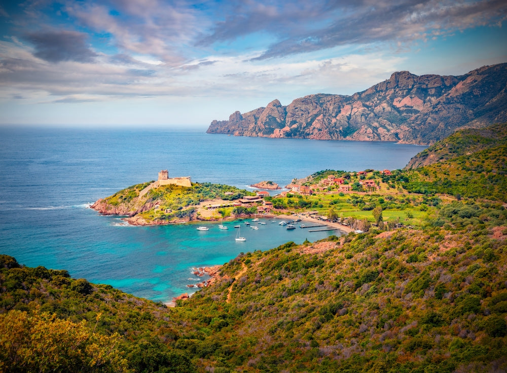
You have to walk to find the best ones. Not far — sometimes twenty minutes — but walk nonetheless. Corsica does not give up its treasures without effort. Saleccia beach in the north, reachable only on foot or by boat: a kilometre of white sand edged with pines, water so turquoise the Pacific would not disown it. Palombaggia in the south, with its pink rocks dotting the horizon like sculptures. The Calanques de Piana, UNESCO-listed, where red rock carves wild shapes above water you can see straight through.
You lie on warm pebbles. You step into cold water, then perfect water. You lose track of time because here, time does not really count.
And then the mountain
The GR20 crosses Corsica from north to south in 180 kilometres of trail. It is considered one of the hardest in Europe — not for the distance, but for the relentless vertical. You climb, descend, climb again. You cross passes at 2,000 metres, walk beside high-altitude lakes of a blue that exists only there, move through black pine forests that absorb every sound.
In the evenings, at the refuges, hikers share the story of their day and their charcuterie. Coppa, barely-aged sheep's cheese, a glass of Nielluccio. Few words, but a deep ease.
What the illustration captures

When you look at our topographic map of Corsica, what strikes you first are the tight lines — contours packed close together, marking steep slopes. The west coast is covered in them: the mountains fall fast into the sea. Then the wider, more open areas to the east: the coastal plain, the river mouths, the lagoons.
Each line tells a story of altitude, season, vegetation type. Where the lines crowd together grow laricio pines and holm oaks. Lower down, the maquis. Lower still, olive trees, vines, beaches.
Corsica holds entirely within this paradox: a place where you can swim and do high mountain hiking on the same day, leaving a white-sand beach at 7am and eating dinner at 1,500 metres with the stars right overhead. Few places on earth allow for that.
Our topographic illustration is its faithful portrait — silent, precise, and for those who know the island, immediately recognisable.